

Day Trips
The Snake River Has a Waterfall Taller Than Niagara, and It’s Two Hours South
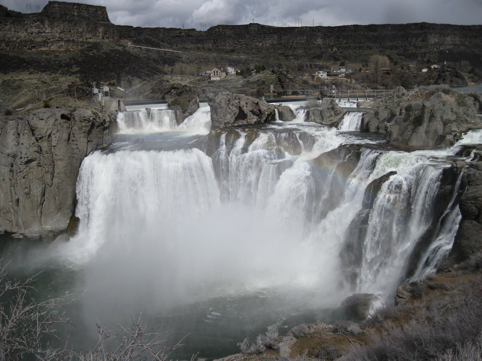
Shoshone Falls, three miles outside Twin Falls, stands 212 feet high and nearly a thousand feet wide—an easy Boise day trip anchored by canyon rim views and a city lunch stop.
Day Trip Route
Downtown Boise, Idaho to Shoshone Falls, Idaho
BOISE, ID—About two hours southeast of downtown Boise, the Snake River drops 212 feet over a basalt rim nearly a thousand feet wide, lands in a canyon, and keeps going. Shoshone Falls has been called the Niagara of the West since at least the 19th century, a nickname it earned honestly: it’s 45 feet taller than the original.
The drive down from Boise follows I-84 through the wide, flat floor of the Snake River Plain. It’s not a scenic highway in the mountain sense—it’s open sky, irrigated fields, and the occasional wind turbine—but something about that flatness makes the canyon’s arrival feel like a trick.

You’re on level ground, and then you’re not, and a gorge up to 500 feet deep opens alongside the road. The Snake River Canyon runs for more than 50 miles through the Magic Valley region, cutting the boundary between Twin Falls County to the south and Jerome County to the north.
Shoshone Falls sits about five miles east of Perrine Bridge, the span that crosses the canyon immediately north of Twin Falls. The falls are managed as a park, and access conditions—including any entry fees or seasonal hours—are worth confirming before you leave Boise. Flow varies considerably depending on time of year and upstream water management, so the falls you find in spring snowmelt season will look different from the falls you find in late summer. Both are worth seeing; they’re just different conversations.

The canyon itself is the second chapter. Perrine Bridge is a reasonable place to stop and look down. The walls are dark basalt layered in columns, carved by water over a very long time. The gorge runs quietly below whatever traffic is crossing above it. Hansen Bridge, east of Twin Falls, offers another vantage point along the canyon’s stretch.

Twin Falls, with a population pushing 56,000, is the largest city in a 100-mile radius and the regional commercial hub for south-central Idaho. That means it has the practical infrastructure a day trip needs: places to eat, places to stop, and a downtown worth a short walk. Plan a lunch stop there rather than trying to eat at the falls, where options may be limited. Verify that any specific restaurant is still operating before you make it part of the plan.
The loose shape of the day works naturally: leave Boise in the morning, reach the falls, spend time at the overlooks and along the rim, drive back through Twin Falls for lunch or an early afternoon stop, then return up I-84. The round trip is manageable without rushing, and the itinerary has enough flexibility that a slow start or a long lunch doesn’t break anything.

One practical note: canyon rim access can be affected by weather, and road conditions between Boise and Twin Falls in winter are worth checking with Idaho 511 before you commit to the drive. The falls aren’t going anywhere, but the interstate can get complicated between December and March.
Shoshone Falls has been a destination long enough that the Smithsonian was documenting it in the 1840s. The novelty, if there is one, is simply that most Boise residents have never been, which is the kind of oversight a free Saturday afternoon can correct.
Story label: Original Story or Guide
Originally published: